Paris 2024: Interactive maps to support spectators during the games
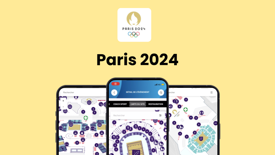
Designed to meet the challenges of a global-scale event, this mapping tool—developed with Wemap—provided effective on-site guidance for visitors across all Olympic locations. Available exclusively to ticket holders through the Paris 2024 app, the maps offered clear, tailored layouts for each venue, helping users locate key services, follow recommended routes, and navigate easily based on their profile or seating area. A key innovation in both the logistical success and spectator experience of the Games.

A Feature Integrated into the Official App
The maps were accessible only to ticket holders via the official Paris 2024 app. The feature proved to be a major success, ranking as the second most-used function of the app during the event.
Each map enabled visitors to:
📍 Identify access points based on their ticket type or mobility needs
🧭 Quickly locate essential services: restrooms, water points, food stands, first aid, etc.
🚶 Move through the different zones using predefined routes
Maps Created Specifically for the Games
All maps were custom-designed for the event, tailored to the specific layout and needs of each venue. A significant design effort ensured perfect consistency with the Paris 2024 visual identity and optimal readability on mobile.
The maps were:
🎨 Visually customized for each site
🎟️ Designed to clearly display zones and seating areas, with clear routing guidance
👥 Publicly accessible with no technical barriers
A Benchmark in Event Cartography
By relying on this dedicated cartographic infrastructure, Paris 2024 delivered a smooth and well-orchestrated on-site experience for spectators—despite the logistical complexity and diversity of venues. A strong use case in large-scale public navigation, where the map becomes a central tool for managing and enhancing the spectator journey.
Main features used
Interested in this use case? Get in touch with our team.
Request a demo%20EN.png)