Paris Tourist Office: A Location-Based Web App to Guide Visitors
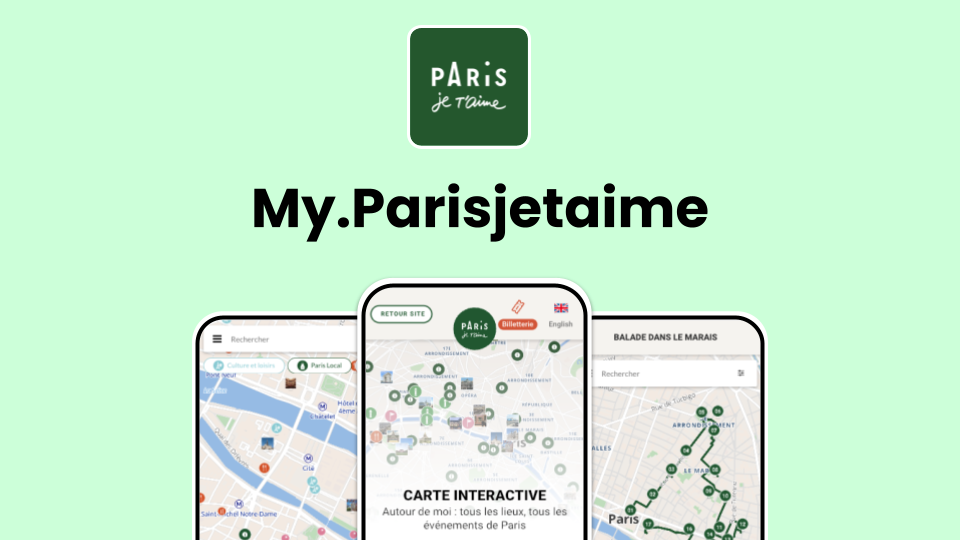
Developed in collaboration with Wemap, the My.Parisjetaime web application brings together the entire range of Paris’s tourist offerings in a geolocated interface, accessible on both mobile and desktop. Acting as a true travel companion, it gives visitors access to rich, dynamic thematic maps featuring iconic landmarks, cultural events, walking tours, practical services, and personalized itineraries. Designed to meet the needs of all audiences—including those with disabilities—this solution delivers a smooth, tailored, and immersive experience that supports a simpler, more inclusive, and more enriching way to discover Paris.

Context: Enhancing the Tourist Experience in Paris
The Paris Tourist Office (Paris je t’aime) faced a major challenge: how to provide millions of visitors with all the essential information they need once they arrive in the city? From must-see landmarks and current events to recommended itineraries, it was crucial to offer a smooth and intuitive solution.
An Interactive and Accessible Solution: My.Parisjetaime
To meet this challenge, we developed a geolocated web application — My.Parisjetaime — which centralizes all of Paris’s tourist information through advanced interactive maps. This innovative tool gives visitors personalized recommendations based on their real-time location, just a few clicks away.
🔹 Key Features:
✅ A global map integrating all major points of interest (museums, monuments, restaurants, etc.)
✅ An event agenda map listing all current and upcoming cultural programming
✅ Themed walking route maps for exploring Paris from a new perspective
✅ An accessible version adapted for people with disabilities, compliant with the Tourism & Disability label (hearing, mental, motor, and visual impairments)
🚀 An Immersive Experience with Advanced Features:
🔍 Smart POI prioritization: Map display dynamically adapts to zoom level to highlight key locations
📍 Real-time geolocation: Users can instantly see what’s around them
🎟 Simplified booking: Clear call-to-action buttons make it easy to book tickets in a few clicks
🚇 Multimodal route planning: Includes walking, cycling (with Vélib’ integration), public transit (with real-time schedules), and taxis
🗺 Detailed venue maps: For example, an interactive map of the famous Père Lachaise Cemetery is available
🔎 Advanced filters & search: Users can customize their exploration based on preferences
A Concrete Impact on the Tourist Experience
With My.Parisjetaime, Paris visitors now benefit from an intuitive, immersive, and accessible digital tool. It helps them save time, better organize their visits, and easily access real-time information. This solution represents a major step forward in supporting tourists and contributes to reinforcing the appeal of the French capital.
Main features used
Interested in this use case? Get in touch with our team.
Request a demo%20EN.png)